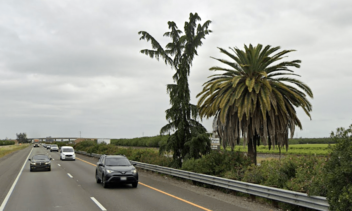
The Palm and Pine, a blink-and-you’ll-miss-it roadside landmark of mysterious origin, will be removed for the widening of Highway 99 near Madera.
Related Articles
Newsom defends progressive values in State of the State
Pedestrian dead in East Bay after being hit by a car
Man dies at hospital after shooting in East Oakland
Why water is the best drink during a heat wave
Hillary Rodham Clinton brings new book tour to Bay Area this fall
The pair of trees are thought to have stood for close to 100 years in the median of 99 just south of Madera. They are said to represent the unofficial dividing line between Northern California (the pine) and Southern California (the palm).
The road project set to begin this summer will widen about 8 miles of the freeway from four lanes to six, and the oleander-filled median strip will be reduced to a concrete barrier, the California Department of Transportation says.
Caltrans spokesperson Larry Johnson told the Fresno Bee that though the two trees will have to be removed, there is a plan for a marker in the center of the road as well as 15 palm trees and 15 pines on the west shoulder.
Nobody has been able to pin down exactly when the trees were put in the median or who decided to do it. The late TV personality Huell Howser did a 1995 episode of his “California’s Gold” series on the Palm and Pine, and Caltrans’ Bob Thomason told him that the agency’s files shed no light on the trees’ origin. It is believed they were there since at least the late 1920s, when the road south of Madera was widened and repaved.
The original pine — actually a Deodar cedar — toppled in a storm in 2005 and was replaced by what looks to be another cedar. The Deodar cedar is not native to California, or to anywhere in the Americas. Its palm partner is also a non-native.
As for the claim that they mark the north-south dividing line, the site is roughly at the half point of California’s length. A drive from Mexico to Oregon through California’s Central Valley would be about 800 miles, with the midpoint somewhere near Madera.
But, as Howser found out, a number of Madera County sites claimed to be the state’s geographical center. The official marker is near North Fork, in the Sierra Nevada foothills about 35 miles northeast of the Palm and Pine.